🇹🇼 Taiwan Guide Taiwan Attractions Day Trips from Taipei Yangmingshan Wulai Taroko 2026 Status About 🇹🇭 Thai🇬🇧 English🇨🇳 中文🇪🇸 Español🇫🇷 Français
🥾 Taiwan Hiking Guide · Updated 2026

Taiwan Hiking Trails
Beyond Taroko — 10 Spots Most Tourists Miss

A volcanic park 45 minutes from downtown Taipei. Rope-ladder crags in a sky lantern valley. The highest summit in Northeast Asia. Taiwan hides world-class trails most visitors never find.

Hiking Guide 2026

Taiwan Is a Hiker's Island That Most People Underestimate

Taroko Gorge is magnificent — but it is only one chapter in Taiwan's hiking story. This compact island packs in active volcanic highlands, indigenous sacred peaks, Pacific coastal ridgelines, ancient cypress forests and the highest summit in Northeast Asia, all within a few hours of Taipei. Some trails are 45-minute day hikes served by city buses. Others require permits booked months in advance and two nights in a mountain hut. Here are 10 routes worth knowing, ranked roughly from easiest to most committing, with honest access details and permit guidance.

🌋
Volcanic Diversity
Active fumaroles, lava domes, alpine cirques and Pacific coastline — one island, every terrain type
🚉
MRT + Bus Access
Several trails start within 45–90 min of Taipei by public transport — no car hire needed
🏔️
NE Asia's Highest Summit
Jade Mountain at 3,952m stands taller than Japan's Mt. Fuji by 600 metres
🎫
Permits Where It Matters
Only Yushan and Snow Mountain need advance permits — we cover every detail below
10 Hiking Trails

Pick Your Level and Start Walking

Ordered from easy to serious — green badges mean walk in, orange means prepare well, red means plan months ahead.

Mt. Qixing summit trail, Yangmingshan National Park, with Taipei visible below 🌋 Volcanic · Taipei1
Easy · 3–4 hrs return
Yangmingshan — Mt. Qixing at 1,120m
Yangmingshan National Park · Summit Trail

Taiwan's most accessible volcano sits on Taipei's northern fringe — sulphurous fumaroles at Xiaoyoukeng, water buffalo grazing the Qingtiangang grassland plateau, and a 2-hour hike to Qixing's summit for a full city panorama on clear days. The trail changes personality with the seasons: cherry blossom in March, silver pampas grass in November.

🚌Access: MRT to Jiantan, then Bus R5 or 108 into the park (~45 min total from central Taipei). No car needed.
📅Best season: March (cherry blossom) · Oct–Nov (pampas grass) · Early morning avoids weekend crowds
🎫Permit: None required. Park entry free.
💡Why not Taroko: Volcanic steam vents, lava domes and a city view — utterly different from a marble gorge
Full Yangmingshan Guide →
Maokong tea farm hillside trails and gondola above Taipei 🍵 Tea Trails · Taipei2
Easy–Moderate · 2–4 hrs
Maokong — Erge Mountain Tea Farm Trails
Maokong Gondola + Erge Mountain Loop

Ride the gondola over tiered oolong tea terraces, disembark at the Maokong terminus and follow the Erge Mountain loop trail through old tea farms, small earth-god shrines and viewpoints over the Taipei basin. End with a pot of fresh-picked oolong at a traditional teahouse on the hillside — one of those afternoons that reminds you why Taiwan is so easy to love.

🚌Access: MRT Circle Line to Taipei Zoo, walk 5 min to gondola station. Gondola fare NT$70. Closed Mondays.
📅Best season: Year-round, though avoid heavy rain. Evening gondola rides offer spectacular city lights.
🎫Permit: None. Use EasyCard on the gondola.
💡Why not Taroko: Walking through a working tea farm — and drinking what you just walked past — is as distinctly Taiwanese as it gets
Full Maokong Guide →
Wulai Waterfall, an 80-metre cascade in the Nanxi River canyon, New Taipei 💦 Waterfall · Hot Spring · New Taipei3
Moderate · 3–5 hrs
Wulai — Pacalan Forest Trail & 80m Waterfall
Wulai — Indigenous Atayal Trails with Hot Spring Reward

The Pacalan trail starts at Wulai Old Street, crosses a suspension bridge, and winds through dense sub-tropical forest past Atayal indigenous settlements to a viewpoint above the 80-metre waterfall. The real payoff comes at the end: a soak in natural sulphur hot springs beside the Nanxi River, where the water runs milky-white. One hour from the city; feels like another world.

🚌Access: MRT to Xindian, then Bus 849 direct to Wulai (~1 hr total from Taipei).
📅Best season: October–May. Avoid heavy rainy periods — the trail can be slippery.
🎫Permit: None required.
💡Why not Taroko: Indigenous culture, a thundering waterfall and hot springs in a single day — Taroko offers none of these in combination
Full Wulai Guide →
Pingxi valley and the dramatic rocky crags of Xiaozi and Cimu mountains above 🧗 Rope Ladders · New Taipei4
Moderate–Hard · 2–3 hrs
Pingxi Crags — Xiaozi & Cimu Rock Scrambles
Pingxi Crags — Three Rocky Peaks with Metal Rungs & Rope Ladders

Three small but genuinely exciting peaks sit above the sky lantern valley at Pingxi. Xiaozi (360m) involves metal-rung ladders on a narrow exposed ridge with drops on both sides. Cimu (410m) adds a short near-vertical rope climb to the summit. The views down into the valley and out to the coast are surprisingly dramatic for peaks under 500 metres. Never attempt these after rain — the rock becomes treacherous.

🚆Access: TRA to Ruifang (~50 min from Taipei Main), transfer to Pingxi Line. Alight at Shifen or Pingxi station.
📅Best season: October–April (dry season). Do not attempt in rain or within 24 hrs of heavy rain.
🎫Permit: None — but proper trail shoes with grip are essential, not optional.
💡Why not Taroko: The adrenaline of exposed ridge scrambling on rope ladders — nothing like Taroko's gorge walk
Pingxi Sky Lantern Guide →
Ancient red cypress trees along the forest boardwalk in Alishan Forest Recreation Area 🌲 Ancient Forest · Chiayi5
Easy–Moderate · 1–4 hrs
Alishan — Sister Pond & Ancient Cypress Trails
Alishan Forest Recreation Area — 2,200m Boardwalk Through Living History

At 2,200 metres elevation, Alishan's forest holds red cypress trees that were saplings when Rome still stood. The Sacred Tree Trail (2 km) is a gentle boardwalk past trunks with girths of 5–12 metres. Sister Pond mirrors the trees perfectly in still weather. The Plum Garden trail in January–February is a cascade of white blossom. This is hiking as meditation — and it's accessible to almost anyone.

🚄Access: THSR Taipei→Chiayi (~1.5 hrs), then Bus 7322 to Alishan (~2.5 hrs). Budget ~NT$700–900 return transport.
📅Best season: Jan–Feb (plum blossom) · Mar–Apr (cherry blossom) · Oct–Nov (clear skies)
🎫Permit: No advance permit — park entry fee NT$300.
💡Why not Taroko: Ancient forest boardwalks and a sunrise above a sea of clouds — a completely different sensory world
Alishan Day Tour Guide →
High-altitude alpine hiking trail on Hehuanshan range above 3,000 metres, Taiwan 🏔️ High Alpine · Nantou6
Hard · 4–8 hrs · 3,000m+
Hehuanshan — East & North Peaks Above 3,000m
Hehuanshan Alpine Ridge — Taiwan's Most Accessible High-Altitude Hike

Route 14A (the Wuling Highway) climbs to 3,275m, making Hehuanshan's car park one of the highest road-accessible points in Northeast Asia. From there, East Peak (3,421m) is an 8km out-and-back with 360-degree alpine views. North Peak (3,536m) adds more elevation and technical terrain. In winter, the slopes dust with snow — the easiest place in Taiwan to see it, no permit required. Acclimatise for a day or two before attempting: altitude sickness here is real.

🚌Access: No direct public transport. Rent a car from Taichung or Puli, or join a guided group. ~3 hrs from Taipei.
📅Best season: Oct–May for hiking · Dec–Jan for snow views · Avoid typhoon season entirely
🎫Permit: None — but spend a night at lower elevation first to acclimatise properly.
⚠️Safety: Headaches, nausea or shortness of breath = descend immediately. Do not push through altitude sickness symptoms.
Compare Taiwan's Best Overnights →
Jade Mountain Yushan summit at 3,952m — highest peak in Northeast Asia 🗻 Highest in NE Asia · Nantou7
Very Hard · 2 days · Permit required
Jade Mountain (Yushan) — 3,952m
Yushan — Highest Summit in Northeast Asia, 600m Above Mt. Fuji

Standing 600 metres taller than Japan's Mt. Fuji, Yushan is the undisputed centrepiece of Taiwan's mountain hiking. The standard route from Tataka Trailhead climbs 8.5km one way to the Main Peak. Most hikers spend a night at Paiyun Lodge (3,402m), then summit at 3 or 4am to catch the sunrise breaking through a sea of clouds far below. It is one of the finest sunrise experiences in all of East Asia — and competition for permits is ferocious.

🚌Access: THSR to Chiayi, then bus to Tataka trailhead via Alishan (~4–5 hrs total from Taipei).
📅Best season: Oct–Dec and Mar–Jun. Avoid summer typhoons and heavy winter ice without crampons.
🎫Permit: Park Entry Permit + Mountain Entry Permit via hikesmartaiwan.tw. Foreign hikers: apply 4 months ahead. Paiyun Lodge must be booked simultaneously — it fills within minutes of opening.
💡Why not Taroko: Yushan is a summit; Taroko is a gorge. One exhausts your legs, the other drops your jaw looking up. Both deserve a slot on your Taiwan list.
Taroko vs Alternatives 2026 →
Xueshan Snow Mountain trail through ancient forest, Taiwan's second highest peak ❄️ Taiwan's 2nd Peak · Taoyuan/Yilan8
Very Hard · 2–3 days · Permit required
Snow Mountain (Xueshan) — 3,886m
Xueshan — Taiwan's Most Scenic High Mountain Traverse

Many experienced hikers consider Xueshan more beautiful than Yushan — the trail passes through old-growth forest before emerging into an ice-carved cirque that looks transplanted from the Southern Alps. The 369 Lodge at 2,940m is the most sought-after mountain hut in Taiwan; beds are snapped up within minutes of the booking window opening at 7am, 60 days ahead. For a longer challenge, the 5-Peaks route links five summits over three days. Plan early — this one rewards the organised.

🚌Access: Bus from Zhongming Market (Taichung) to Wuling Farm trailhead (~2.5 hrs), or drive from Yilan.
📅Best season: October–June · Winter views feature ice formations on the cirque walls
🎫Permit: Park Entry Permit via hikesmartaiwan.tw (no Mountain Permit needed). Book 369 Lodge 2 months ahead — foreign quota available but limited.
💡Why not Taroko: Deep forest, an ancient glacial cirque and a mountain hut overnight — the trail experience here is richer and more sustained
See Taroko 2026 Status →
Pacific Ocean and Turtle Island (Guishan Dao) viewed from Caoling Historic Trail ridge 🌊 Pacific Coast · New Taipei9
Moderate · 3–4 hrs · 10km
Caoling Historic Trail — Pacific Views & Turtle Island
Caoling Trail — 130-Year-Old Qing Dynasty Path Along the Northeast Coast

The last surviving section of a Qing-dynasty trail that once linked Tamsui to Yilan, Caoling is a 10km point-to-point that crosses a ridge between the northeast coast and the Yilan plain. The views from the top are the reward: the Pacific spreads endlessly east, and turtle-shaped Guishan Dao floats offshore like a mirage. In October and November, silver pampas grass covers the ridge in moving waves of light. Walk in from Fulong, ride the train back from Dali.

🚆Access: TRA to Fulong (~1 hr from Taipei), 30-min walk to trailhead. Return from Dali station via TRA to Taipei.
📅Best season: Oct–Nov (pampas grass) · Mar–May (cool and green) · Avoid heavy rain days
🎫Permit: None. Free public trail.
💡Why not Taroko: Open sky and ocean instead of narrow canyon walls — the best permit-free alternative to Taroko in northeast Taiwan
Taroko 2026 Alternatives →
Dense subtropical old-growth forest on the approach to Beidawu Mountain, sacred to the Paiwan people of Pingtung 🌿 Sacred Paiwan Territory · Pingtung10
Moderate–Hard · 2–3 days
Beidawu Mountain — 3,092m & Southern Taiwan's Deepest Forest
Beidawu (Kavulungan) — The Only 3,000m+ Peak in Pingtung, Sacred to the Paiwan & Rukai

The highest peak in southern Taiwan and one of the least-visited mountains on the island. Beidawu — known in Paiwan as Kavulungan — is considered sacred to both the Paiwan and Rukai peoples; young tribal members still make the three-day ascent as a coming-of-age ceremony. The trail passes through extraordinary old-growth forest, past the Kuaigu overnight shelter and the Dawu Shrine, to a summit at 3,092m with sweeping views south toward the Bashi Channel. You are unlikely to encounter other foreign hikers.

🚆Access: TRA to Fangliao station, then taxi or hired car to Taiwu trailhead (~1 hr). No public transport to trailhead.
📅Best season: April–November. Avoid typhoon season and heavy rain periods.
🎫Permit: Register online (mountain entry) and check in at Taiwu Police Station before ascending. Officers verify every hiker entering and leaving.
💡Why not Taroko: Ancient forest, living indigenous culture and genuine solitude — the Taiwan that most visitors never reach
Explore All of Taiwan →
Plan Your Hike

Read the Full Guides Before You Set Off

🏕️

Taroko 2026 Status

Which trails inside Taroko Gorge have reopened after the 2024 earthquake — and what to do instead if your target route is still closed.

Taroko 2026 Update →
🌋

Yangmingshan Full Guide

Bus 108 circuit, Qixing summit trail, Xiaoyoukeng fumaroles, cherry blossom and pampas grass timing.

Yangmingshan Guide →
💦

Wulai Full Guide

Waterfall, log train, hot springs and Atayal cultural street — half day or full day from Taipei.

Wulai Guide →
🌲

Alishan Day Tour Guide

Getting there from Taipei, the forest railway, Sister Pond and why you should really stay overnight.

Alishan Guide →
🇹🇼

Taiwan Attractions

12 of Taiwan's top destinations from Taipei 101 to Sun Moon Lake and the Rainbow Village.

All Taiwan Attractions →
🗺️

10 Day Trips from Taipei

No permits, all on public transport — the classic escapes that every Taipei visit deserves.

Taipei Day Trips →
Practical Tips

6 Things That Make Taiwan Hiking Go Smoothly

🥾
Grip Matters More Than You Think
Flat-sole trainers become ice skates on wet stone at Pingxi and Wulai. Proper hiking shoes with lug soles are essential for any hard-rated trail.
💧
Carry More Water Than Usual
Hehuanshan and Beidawu have no resupply points. Pack at least 2L per person — altitude increases your fluid needs without you noticing.
📋
Apply for Permits Early
Yushan: 4 months in advance for foreigners. Snow Mountain: 2 months. Both use hikesmartaiwan.tw — create an account with your passport before you need it.
🌤️
Check Hourly Weather Forecasts
Taiwan's mountain weather changes fast. Use weather.gov.tw and Windy for ridge-level forecasts, not just the city forecast below.
🏨
Book Mountain Huts at the Same Time
369 Lodge (Snow Mountain) and Paiyun Lodge (Yushan) are booked through the same permit system — they vanish in minutes. Set an alarm for 7am on your booking day.
📞
Leave a Trip Plan with Someone
Mobile signal fails on Beidawu and parts of Hehuanshan. Tell someone your planned route, hut name and expected return date before you leave the trailhead.
FAQ

Taiwan Hiking — Questions We Hear Most

Which Taiwan hiking trails require no permit?

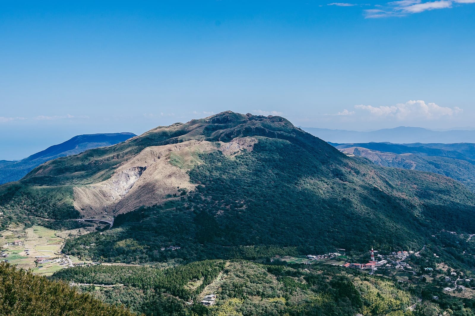
Yangmingshan, Maokong, Wulai, Pingxi Crags, Alishan Forest trails, Hehuanshan and the Caoling Historic Trail all require no advance permit — just show up with the right gear. Jade Mountain (Yushan) needs both a Park Entry Permit and Mountain Entry Permit via hikesmartaiwan.tw; Snow Mountain requires a Park Entry Permit only. Beidawu requires online registration and check-in at Taiwu Police Station.

When is the best time to hike in Taiwan?

Autumn (October–November) and spring (March–May) offer the most comfortable conditions — mild temperatures, lower rainfall and clearer skies. For high-altitude peaks like Yushan and Snow Mountain, October–December and March–June are optimal. Typhoon season (July–September) brings real risk on exposed ridges and should be avoided for all serious mountain hikes.

How do foreign hikers apply for Yushan permits?

Apply through hikesmartaiwan.tw using your passport number. You need both a Park Entry Permit and a Mountain Entry Permit for Yushan (Jade Mountain). Foreign hikers have a separate quota that fills extremely quickly — apply 4 months in advance for any weekend date. Book Paiyun Lodge (the overnight shelter at 3,402m) simultaneously when the booking window opens at 7am. A guide is not legally required but is strongly recommended for first-time high-mountain hikers in Taiwan.

Which Taiwan hike is best for beginners?

Yangmingshan's Qixing Summit trail (2 hrs, 1,120m, no permit, 45 min from Taipei by bus) is the most accessible starting point. Alishan's forest boardwalk trails are gentle enough for anyone with basic fitness. The Caoling Historic Trail is 10km with moderate elevation and delivers one of the best coastal views in Taiwan — accessible by train, no permit, manageable in half a day.

What gear do I need for hiking in Taiwan?

For low-altitude trails (Yangmingshan, Wulai, Caoling): trail shoes with grip, 1.5L water, sunscreen, a light windproof jacket. For Hehuanshan, Yushan or Snow Mountain: add a heavy insulating layer, gloves, a beanie, a sleeping bag rated to -5°C, trekking poles, 2–3 days of food, a headlamp and altitude medication (Diamox — consult a doctor before taking). Do not underestimate the cold at 3,000m+ even in summer.

Is Taroko still closed, and what are the best alternatives in 2026?

Parts of Taroko Gorge remain partially closed following the April 2024 earthquake, with several iconic viewpoints including Yanzikou inaccessible as of early 2026. Short walks like the Baiyang Waterfall Trail may be accessible — check the Taroko National Park website for current conditions before visiting. For alternatives: Caoling Trail offers equally dramatic northeast coast scenery without canyon access issues; Wulai delivers indigenous culture and a waterfall; and Hehuanshan gives you Taiwan's high-altitude drama without needing Taroko at all.
Ready to Hit the Trail

Choose Your Trail
Then Plan the Rest of Your Taiwan Trip

Open the full Taiwan travel guide, or search for hotels near your chosen trailhead — Taipei for northern trails, Chiayi for Alishan, and Kaohsiung or Pingtung for Beidawu.

🥾 Book Hiking Tours Taiwan Guide