10 places worth your time
Ordered from in and around town out to the mountains and the villages further afield.
 1
1
The heart of Mae Hong Son town is Nong Jong Kham, a lake in the centre with two Burmese-style temples standing side by side on its edge — Wat Chong Kham and Wat Chong Klang. Their tiered wooden spires, gilded fretwork and coloured glass reflect beautifully in the water at both dawn and at night when they are lit. You can stroll the whole way around the lake; entry to the temples is free. Inside Wat Chong Klang are carved wooden figures and glass paintings telling Jataka tales. It is a working temple, so dress modestly with shoulders and knees covered. It is a lovely first stop in the late afternoon or early morning before heading elsewhere.
 2
2
Look up from town to the hill on the west and you see two white chedis standing out — Wat Phra That Doi Kong Mu, the Shan-Burmese temple that watches over Mae Hong Son. You can drive or ride right up to the temple terrace, and from there you get a view over the whole town and valley laid out below, lovely at sunset and at night when the town lights come on. On some cool-season mornings, mist sits over the town like a sea of fog. It is a good first stop on day one to get the lay of the land. It is free to visit, with a donation box if you would like to give.
 3
3
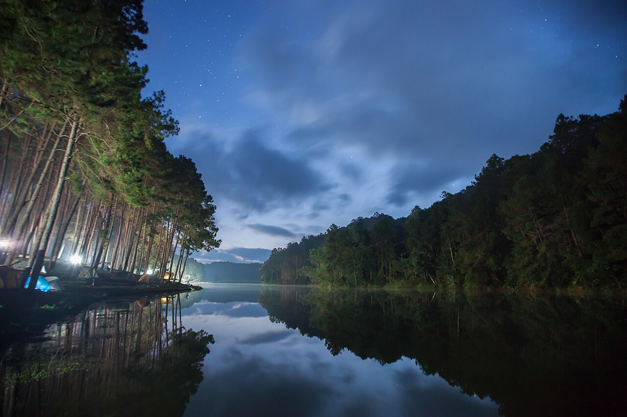
Picture this: you are standing by the water at 5am, it is bitterly cold, and white mist slowly drifts over a surface that mirrors the pines perfectly. This is Pang Ung, a small reservoir ringed by pine forest that people call the "Switzerland of Thailand". The real magic is at first light in the cool season (Nov–Feb), with the mist and the reflections. Be honest with yourself: you have to be up very early and there before the sun gets strong, because if you arrive late, or come in the rainy season with no mist, it is just a pretty reservoir. Pang Ung is about 40–45 km out on winding mountain roads, so you need a car or a tour; many people stay nearby or camp to catch the morning mist.
 4
4
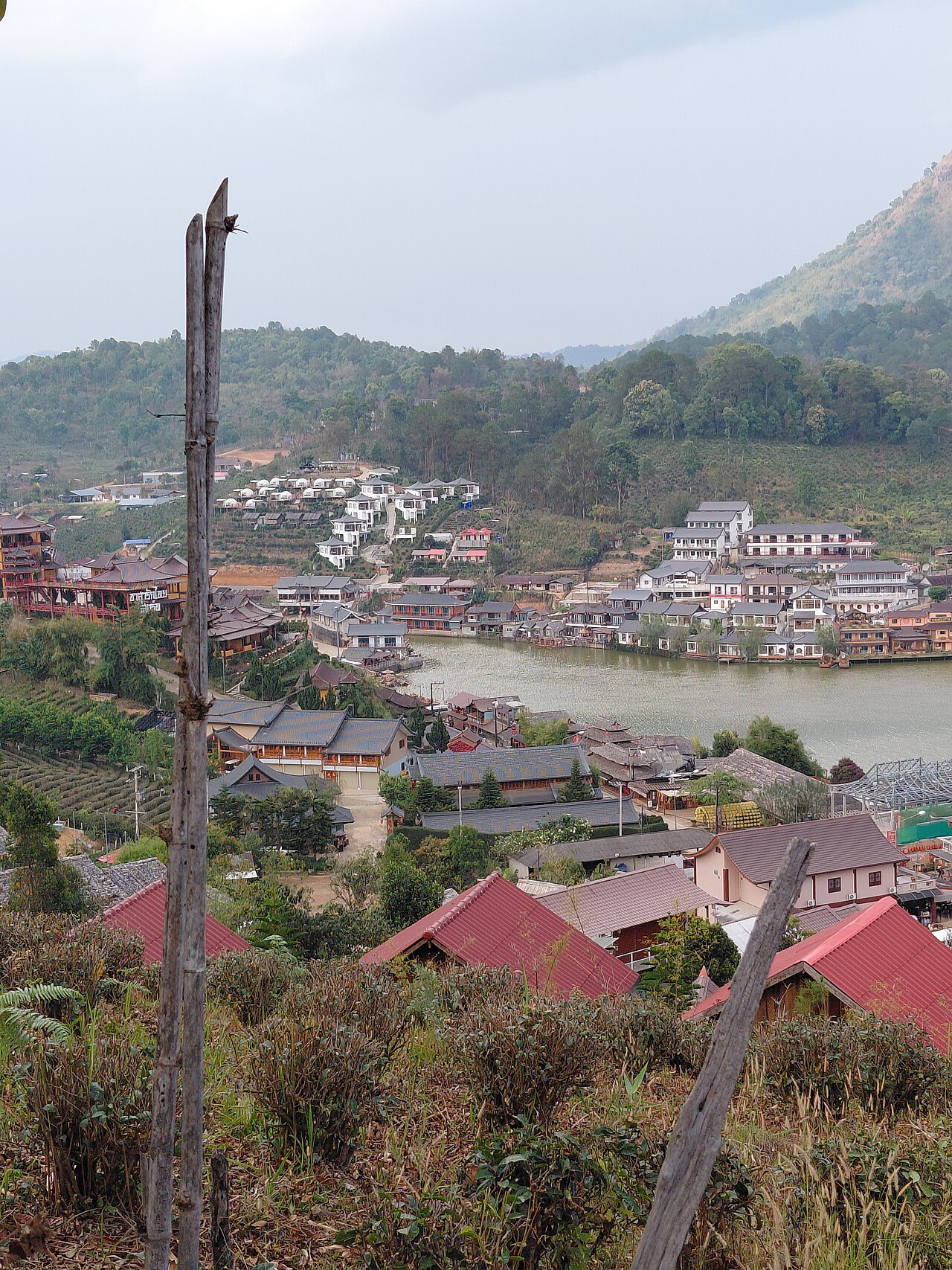
Drive high up to the north, close to the Myanmar border, and you reach Ban Rak Thai, a Yunnanese-Chinese village (settled by former KMT 93rd Division soldiers) that has grown into one of the prettiest lakeside tea villages in Thailand. There are clay houses in a Chinese style, terraced tea gardens, lakeside teahouses where you sip oolong with a view, and Yunnanese food such as braised pork leg with mantou and black-chicken herbal soup. The air is cool and it feels like another country. Walking around is free; you pay only for food, tea and lodging. We write about this Yunnanese-Chinese heritage with respect — it is a living community. Many people stay the night for the cool air and the morning mist.
A short way out of town is the Su Tong Pae bridge, a roughly 500-metre bamboo walkway stretched over the rice fields, linking a village to a forest temple. It was built by villagers and monks, and the name Su Tong Pae means "the bridge of successful prayer". In the early morning, monks cross it on their alms round, and that is the image people come to catch. It is at its best when the paddies are green (around Aug–Oct) or golden at harvest (Nov), when the fields change colour. Crossing is free, with a donation box. Be honest: out of the rice season the fields are bare earth and far less photogenic. It is a short stop, usually folded into a route out of town.
 6
6
Over in Pang Mapha district (Soppong), on the way in from Pai, is Lod Cave (Tham Lod), a large limestone cave with a stream running right through it. The draw is floating in on a bamboo raft with a local guide carrying a lantern, past stalactites and ancient teak coffins. There are three chambers to climb up and explore, and at dusk you can watch hundreds of thousands of swifts stream back into the cave in a long ribbon — well worth waiting for. You hire a guide and a raft at the entrance (guide plus raft fee, check on arrival). It fits neatly into the drive in or out of town via Pai.
On the road up toward Ban Rak Thai and Pang Ung, north of town, there are two nature stops to pull in for — Pha Sua Waterfall, a wide limestone cascade that tumbles in tiers, fullest and best in and after the rainy season (Jun–Nov) and thinner in the dry months; and Tham Pla (the Fish Cave forest park), where a clear stream flows out of a cave full of large soro-brook carp that locals consider sacred, so they are never caught. You walk a shaded boardwalk through the forest. The two sit close together and are usually done on the way north. Entry to Tham Pla is around ฿20–40 per person (check on arrival).
 8
8
For a short window from about mid to late November each year, Doi Mae U Kho in Khun Yuam district turns into fields of Bua Tong (Mexican sunflowers), with whole hillsides glowing gold against the clear cool-season sky. It is an annual highlight that draws people from across the country, with viewpoints and walking paths on the hill. Be warned that the bloom window is very short, and the peak weekends get crowded with traffic backing up on the road to the hill, so go on a weekday or early in the morning, and check that year's bloom news before you plan — arrive in the wrong week and the flowers may be over or not yet open.
Around Mae Hong Son there are Karen and Kayan villages, including the communities known for the brass coils worn around the neck — the people often called "Long-Neck Karen". This deserves an honest word, because there is a real ethical debate: some villages are run as paid attractions, and many Kayan are refugees from Myanmar with limited status, so critics argue certain set-ups treat people like a human zoo. If you do go, choose a village that is community-run and where the money reaches the residents, and always ask before photographing anyone. Treat people as your hosts, not an exhibit, and buy weaving and crafts directly from the makers without haggling them down. If it does not sit right with you, spending the time on the nature and temples instead is a perfectly good choice.
 10
10
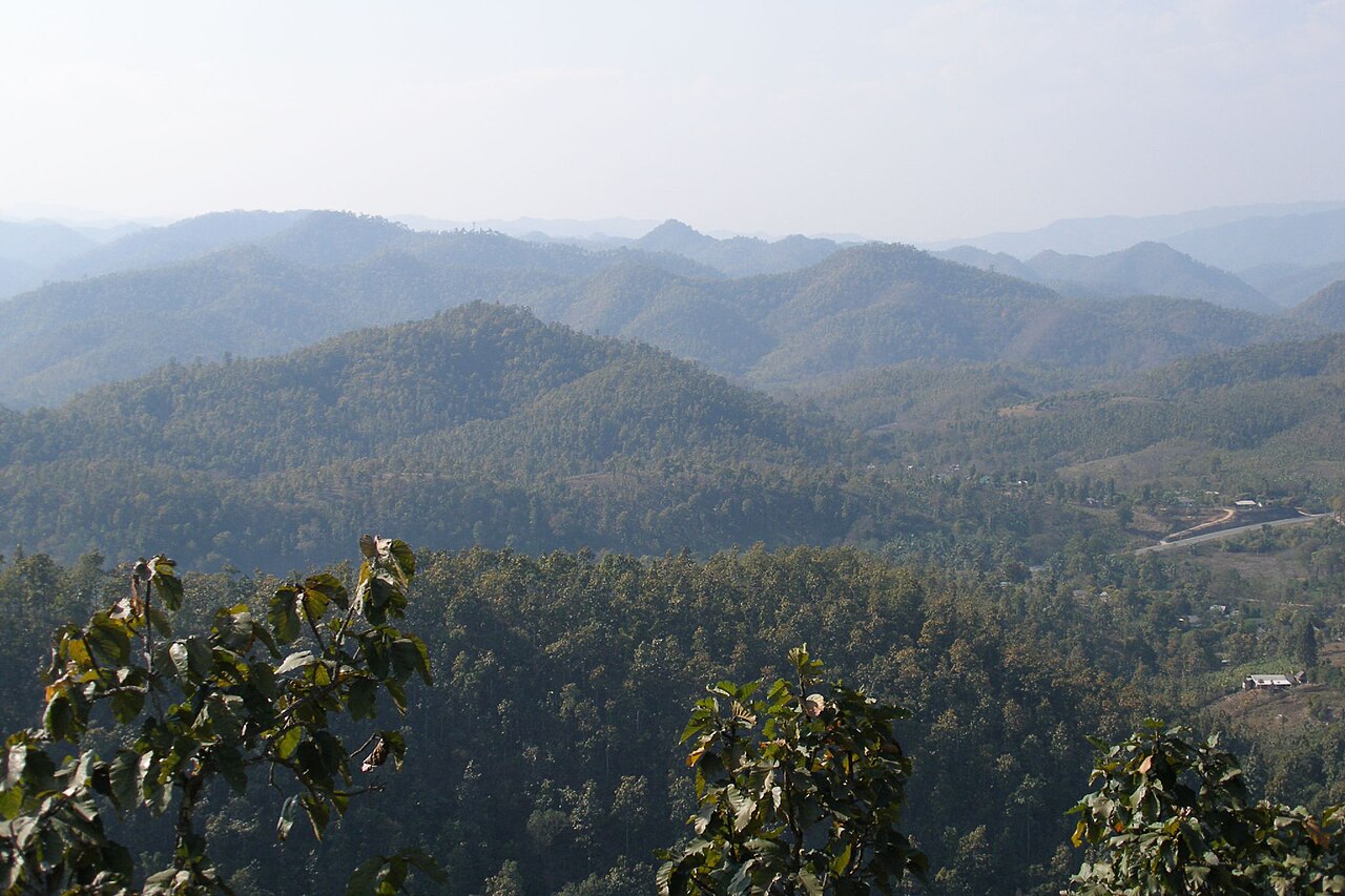
Getting to Mae Hong Son is itself one of the sights — the Mae Hong Son loop, a roughly 600 km road trip from Chiang Mai through Pai, Soppong, Mae Hong Son, Khun Yuam and Mae Sariang and back. It is famous for its roughly 1,864 curves, driven by car or motorbike over about 3–5 days, collecting Pang Ung, Ban Rak Thai, Lod Cave and the Bua Tong fields along the way. It is one of the finest drives in Thailand. Be honest with yourself about motion sickness, because the curves are relentless — take a travel-sickness tablet, drive in daylight, and check your fuel and brakes before you set off. We have split out the route, the stops and how to drive it in the full loop guide.